Wednesday, March 30, 2011

Industrial School for Crippled and Deformed Children

This is a late addition to this entry (1/30/12). From the Boston Globe, August 16, 1941.


Industrial School for Crippled and Deformed Children, 1928.


Founded in 1893, the Industrial School for Crippled and Deformed Children was located on St Botolph street opposite the Boston Arena (the Arena was built just after the school). The school was founded by two orthopedic surgeons from Boston's Children's Hospital who were concerned about the educational opportunities available at the time for the children they served. If you click on the map for a larger image, you will see that the building is in two parts. The original school is the smaller of the two sections to the upper right. In 1923, the institution added the larger building on the left, which included a high school and other facilities. The school was still at the site in the 1980s, when they finally moved to Lexington under the name the Cotting School.

It was the name of the school that caught my eye while I was scanning through maps to locate another institution for an earlier post. It brought to mind the fact that during the first great surge of Boston's philanthropic efforts, the language used to name the resulting institutions was often quite direct. These people, who did so much for those they served, saw no need for euphemism, presumably because they saw no fault with the words they used. They followed the practice of the past - the insane of the city were sent to the Insane Hospital. I point this out not to deny the value of the name changes we've seen in recent decades for various handicaps and conditions, but to suggest that those who created the original names were no less virtuous than ourselves. We get the most out of history when we seek to understand, not judge.

Monday, March 28, 2011

Book Club: Two Years Before the Mast


I'm taking a break from standard illustrated history books to discuss Richard Henry Dana Jr.'s Two Years Before the Mast. Originally published in 1840, the book tells of Dana's work on the brigs Pilgrim and Alert in the California cowhide trade. Dana was from a well to do family, and when measles caused his eyesight to go bad, he was advised to travel in hopes of improvement away from the strain of reading.

Life at sea for a common sailor in the 1830s was little different from slavery, and Dana wrote the book as an expose of the hard lives of sailors. So how is this a Boston book? I thought you'd never ask. Boston - and New England - boys sailed the world during the early 1800s, and some of those became captains and ship owners whose work generated the wealth that built Victorian Boston. The story of Boston's overseas trade is very much the story of the city itself. Dana's book gives us insight into a way of life that Bostonians would have taken for granted during the 19th Century, but is largely forgotten now. The book was very successful in its day, and Dana was a leading citizen of the city.

I will admit that I skimmed a good deal of the book - the details of rigging a sailing ship are less entertaining today than they were to the land-bound readers of the time. However, I would not hold that against the book. The good parts are very good stories of life on board ship, sailing around the Horn, dealing with a dictatorial captain, and the rest of a common seaman's life. The book is available online for free, or you can get a copy at the library.

Please note that there is a later, larger version that was published when Dana had traveled back to California and revisited the locations he knew as a sailor.

Tuesday, March 22, 2011

Boston's Reservoirs

Beacon Hill reservoir - view from the State House, looking down the back of Beacon Hill towards the West End.

Once upon a time (as they say), Boston's drinking water supply was provided by individual wells. Indeed, the first Puritan settlers came to the Shawmut peninsula from Charlestown, where they suffered from the lack of easy access to water. The future Boston, on the other hand, had free flowing springs and well water easily accessible through light soil.

As the town grew, the need for water outstripped the availability. After an examination of the ponds of local communities, Jamaica Pond in the town of Roxbury was chosen, and in 1796, the Jamaica Plain Aqueduct Company was formed, and pipes of wooden logs were lain from the pond, along the Muddy river and across today's Mission Hill neighborhood to Boston. Jamaica Pond could not supply the entire town (later city) with drinking and fire-fighting water, however, and within a few decades Boston was looking for another, larger source of water.


Beacon Hill reservoir - 1883. Shown behind the original pre-addition State House building.


East Boston reservoir (BPL Flickr photo group).


East Boston reservoir, 1884.


South Boston reservoir, 1884.


With a growing population and a growing need for water, Boston looked west, and secured a new supply from a newly constructed Cochituate water system in 1848. Three distributing reservoirs were built within the city. There were at Beacon Hill, South Boston and East Boston. The Beacon Hill reservoir was built where the monument once stood, although due to leveling of the hill for fill, the foundation was seventy feet lower than the original peak. The reservoir held over 2.6 million gallons of water at just over 100 feet above tide marsh level. The South Boston reservoir, on Telegraph Hill, held 7.5 million gallons, and the East Boston reservoir, on Eagle Hill, had a capacity of 5.6 million gallons. Beacon Hill reservoir was torn down to make way for the expansion of the State House. The South Boston reservoir was torn down and replaced by South Boston High School by 1899. In East Boston, by 1922 the reservoir had been replaced by a playground. In 1926, the new East Boston High School was built on the site.


Roxbury standpipe - Fort Hill (BPL Flickr group).

In 1868, Roxbury was annexed to Boston, followed by Brighton, the short-lived town of West Roxbury and Dorchester. With a need to supply land sitting at higher elevations than much of Boston proper, the Cochituate Standpipe would be added to the system at Fort Hill in Roxbury. An interior water tank was surrounded by a spiral staircase and an outer brick tower wall. In later years, some would confuse the tower structure and the name of the location (Fort Hill), and assume that the post-Civil War water storage structure was the remains of a Revolutionary War fort. In fact, the hill was fortified during the occupation of Boston by the British - the hill guarded the road from Boston to Dedham, where the revolutionary forces kept arms and ammunition - but it was an earthworks fort.

Parker Hill reservoir, Roxbury, 1899.

The map above shows the Parker Hill reservoir. The Mission hill neighborhood and downtown Boston are to the top of the map, and Hyde square and Jamaica plain to the bottom. The connection goes down the hill to Heath street. The Parker Hill reservoir was built in 1873-74, with a capacity of 7.2 million gallons. Being at a much higher elevation than Fort Hill, the Parker Hill reservoir eventually replaced the nearby standpipe. In time, the pumping station at Chestnut Hill - which itself replaced a pumping station at Roxbury Crossing - would replace the need for elevated reservoirs in the city itself, thus clearing the way for the reuse of the lands by the city described above.

Finally, just for the sake of completeness, I'll add the original water tower on Bellevue Hill in West Roxbury. Bellvue Hill is the highest point in the city, and as old farmland was divided and developed, the new population needed a reliable water supply. This structure has since been replaced by a larger metal tank on the same site. Now surrounded by trees and hidden away, we can see from the postcard above that the site once allowed a great viewing site of the city.

Now - here's a little Easter Egg in this otherwise prosaic article on Boston's Victorian era waterworks for those who have stayed with me this far. During the 1960s, a commune formed around musician/cult leader Mel Lyman on Fort Hill. Combine 60s music with LSD and a Messianic loop-de-loo and you've got quite a story for our non-smoking, button-down times. Just punch Lyman's name into a search engine and you'll get the story, in its various insider/outsider versions. Lyman's 'family' are very much of the Sixties - a small, exceptional group, but one that does tell much of the time. While San Francisco far outdid Boston for both music and LSD, our fair city did have its very own nutter-guru.

Monday, March 21, 2011

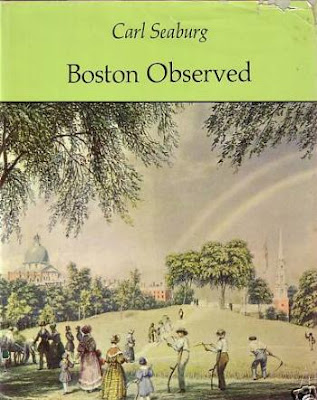
Book Club: Boston Observed


Carl Seaburg's Boston Observed is an illustrated book that was published in 1971. A majority of the illustrations are prints, which allows Seaburg to display scenes unavailable to the photographer. The book is divided into topical chapters, focusing on the harbor, military, lawyers and judges, ministers and religion and the like. You get historical text associated with illustrations, separated by inter-chapter 'interludes:' collections of short passages from contemporary letters, town records, travel diaries, etc. These include John Winthrop's journals, a passage from Dickens' American Notes, The Autobiography of Malcolm X, and observations from Friedrich Engels.

Reading a book like this is like walking through a museum. In one room, you stay and linger, in another you pass through quickly. It's definitely worth a look, but as a whole not a lot that really grabs me. The illustrations are all black and white, and the printing isn't up to contemporary snuff, so maybe that fact puts me off just a little. A good library book - I just wouldn't pay for it.

As an addendum, I'll add a personal comment. Every so often through this book on Boston history, the author saw fit to insert his political opinions. Writing in the early 1970s, he drops in a "just as in past wars, so, today, in Viet Nam." I'm not sure if this sort of thing was in the air, or if he just couldn't help himself. I am surprised that his editor let it through, being entirely irrelevant to the text.

The more grating text comes here: "On March 14, 1859, a young Catholic pupil, Thomas Wall, was brutally whipped for half an hour by a bigoted Protestant teacher because he refused to read the Ten Commandments in the Protestant translation,which his father had forbid him to do. When charges were brought against the teacher, the School Committee blandly defended him. A century last such incidents would be repeated with Irish teachers whipping young Negro pupils for equally insane reasons."

Really? I went to those Boston public schools in the years referred to, and I don't remember many Irish teachers, much less half hour whippings of black students. I do, however, remember taking a few whacks of the rattan across my partially-Irish palm from Mr Clement in the sixth grade. This sort of 'make it up to make a point' editorializing is not uncommon, of course, among the 'ends justify the means' crowd. It's just a shame it was allowed to seep into this otherwise perfectly reasonable book. Bigotry in the cause of anti-bigotry is not a virtue.

Tuesday, March 15, 2011

Lost Train Stations: Boston and Providence RR

Boston, 1853 (BPL)


This is the start of a series I'll be doing on the lost train stations of Boston. The general layout of Boston's railroad lines today is much similar to what we see in the 1853 map shown above. Here we see the very beginning of the great Back Bay fill project. The Public Garden has been extended into the Charles river estuary over land that had formerly been used as rope walks (rope-maker's buildings). The two dotted lines that cross near the word BASIN are the Boston and Providence and Boston and Worcester lines, built on solid fill and on trestles across the shallow waters of the bay.

The Boston and Providence line came through Roxbury and across the bay to today's Park square (from the lower left corner of the map up towards the upper right). The company was chartered in 1831, and began running in 1834. Bostonians had long traveled by land to Providence before transferring to a ship for the trip to New York City, and this was true until a rail line connected Providence to New York. The sea route from Boston to New York City was a sailor's nightmare, with shoals off the outer Cape and Nantucket making the area a graveyard of ships. Thus, the Boston to Providence route served to cut the danger of such travel.

When originally built, the line ran north across the back bay waters, and in to the city just enough to build a station. As the Back Bay district was filled during the second half of the 19th Century, this left the station at Park square in the middle of the city, rather than at its edge.


Bird's Eye view of Boston and Providence station, Park Square, 1870  (BPL).

Here we see the old station at Park square, with the Public Garden and the new Boylston street filled with buildings. The original station, shown here, was removed and a new one built slightly to the south to allow the new Columbus avenue to reach Park square. This Park square location allowed commuters from south of the city to walk or take carriages to work, making suburban living possible for not just the retired well-to-do, but for active working men as well. And of course, their wives could visit Boston shops, and both could avail themselves of the cultural advantages of the city. It was the railroads that allowed the first great exodus from the cities, not the automobile.


The"new" Boston and Providence station, Park Square (BPL).


Boston and Providence station (BPL).

The photo and print above show a large Victorian station with a tower at Park square. This building was erected in 1874. The street cutting across the building at an acute angle is Columbus avenue.


The Park square station being torn down. (BPL).


Here we see the station after it had been replaced in 1899. The Providence line terminus had been moved to South Station. If you look at the map above, the spot where the two railroad lines crossed in the Back Bay was now filled and built upon, and was made home to the new Back Bay station. Here, the Providence line turned to join the old path of the Boston Albany line to the new South Station terminal. So when you stand in front of the Back Bay station today, you can imagine yourself in the middle of the shallow bay, standing on the trestle where the two lines once crossed.

Monday, March 14, 2011

Book Club: The Late George Apley


I'm taking a break from history books and picture books and map books to recommend a novel. The Late George Apley, subtitled A Novel in the Form of a Memoir, was written by John P. Marquand in 1937. The narrator has been asked to write the memoir by the son of the late Mr. Apley, and he does so using letters and other documents, and occasionally his own memories.

The Late George Apley is known as a picture of Brahmin Boston, but it was written at a time when the specific Boston Brahmin species barely existed any more - the suburbs and events having taken and overtaken them. We see Yankee Boston through the lens of a man already dead, his father, his grandfather, and the collective past of a parochial society.

What this book is not is an anthropological study of Protestant Victorian Boston. It is the study of a man's life - a man who happened to live in a particular place at a particular time. More than anything else, this is a story of how a man deals with middle age and mortality. The Late George Apley is as much the story of the end of the Boston Brahmins than of their lives. This is does with a subtle humor that retains a respect for its subjects.

Marquand was raised in Newburyport, attended Harvard, and worked as a reporter for the Boston Evening Transcript. He is probably best known today for his Mr Moto novels, but he won a Pulitzer prize for Apley, and was considered one of the best American writers of his time. All of his 'serious' novels fell out of print for a time - and lost their critical acclaim - probably due to his success as a popular writer. Where else but in criticism does popular success lead to distaste?

Wednesday, March 9, 2011

Mechanic's Hall

Looking south down Huntington avenue. The dome of the Christian Science Mother Church can be seen in the background, the Boston and Albany railroad yards to the right, and the tower of Mechanic Arts High School in the right background (BPL Flickr group).


Corner of Huntington avenue and West Newton street. This postcard view shows the building looking back up Huntington avenue from the view above.

On this 1928 map, Mechanic's Hall is marked in blue. The Boston and Albany train yards sit between Boylston street and Huntington avenue, and Copley square and the Public Library are at the upper left.

Mechanics Hall was erected in 1881, and sat between Huntington avenue and the Boston and Albany railroad yards. The Massachusetts Charitable Mechanics Association was founded in 1795, the founding members including Paul Revere. The goal of the Association was to encourage the mechanic arts, and the founding members included hatters, bakers, coopers, printers, goldsmiths, and just about every other craft and professional skill. The organization sponsored exhibitions, gave to charitable causes, and collected a library. Their first building was at Bedford and Chauncey street, and they moved to Huntington avenue in 1881.

Mechanics Hall was the convention center of its day, with exhibitions of furnaces and other industrial goods, sporting events, and concerts, including the Original Dixieland Jazz Band. In 1959 it was taken down for the Prudential Center complex.

Monday, March 7, 2011

Book Club: Boston Beheld


This book, subtitled Antique Town and Country Views, is by D. Brenton Simons. It is a lovely collection of 18th and 19th Century paintings of Boston and environs, many unavailable in the other Boston picture books I've looked at recently. As much as I love 19th Century photographs of buildings and street scenes, there's something about color paintings, even when less than 'photographic,' that bring the past to life. There are idyllic panoramas of Boston from Roxbury, the harbor and islands, and streets lined with houses that disappeared under commercial buildings. You get to see shops, the clothing people wore, the carts and wagons that filled the streets, and even fires that brought grand buildings down.

Each painting is dated, and descriptive passages help us relate the scene to the present. Page by page, the viewer is given the opportunity to go back in time, and stand at a particular corner, or on a particular hill and see the city as contemporary residents and travelers did. So much that is shown is gone now, but then it had to go to build the modern Boston we know now. Gardiner Greenes's grand mansion and terraced gardens, which we see in two paintings, stood on a hill that no longer exists, and was replaced with Pemberton square, which itself was torn down to build a courthouse on the side of Beacon Hill.

Definitely get a hold of this book to see the Boston that predated photography - it's a gem.

Thursday, March 3, 2011

First Spiritual Temple - Exeter Theatre

First Spiritual Temple, Exeter and Newbury streets.


Spiritualism stands in an odd place in American culture. When considered at all, it generally gets associated with Ouija boards and Hollywood seance scenes from 1930s-40s movies. Beyond that, you might have seen reference to Harry Houdini debunking spiritualists and psychics. This is actually a shame, because there is much more to the story of Spiritualism than 20th Century frauds and fiction plot devices.

The subject of Spiritualism is beyond the scope of this blog, but I would encourage anyone interested to dig in and read up on this fascinating topic. Here, I'll just give a taste of the subject. Spiritualism began in New York during the 1840s, in what was known as the 'burned over district.' In an atmosphere of religious ferment, people began to contact spirits of the dead, through table rapping, and later direct communication with mediums. In time there would be levitating trumpets and 'spirit closets,' but there was much more to Spiritualism than illusions and tricks

Spiritualist meetings hosted some of the very first public speeches made by women in the United States. With no male hierarchy, Spiritualism allowed women the opportunity to take leadership roles in public for the first time. Spiritualism became closely associated with women's suffrage and abolitionism in the years before the Civil War. Many of the earliest leaders of what we would consider the women's rights movement were also Spiritualists.

Over time, interest in Spiritualism waned. The Civil War and exposure of fraudulent mediums both lessened interest in the subject. Eventually Spiritualism was seen more as a parlor game than a religion, but interest did remain at a lesser level. While a lack of hierarchy was once a virtue and attraction for Spiritualism, organized churches did come about. The photo above shows one of them.

The first Spiritual Temple was built on Exeter street at Newbury street. Built in 1885, it had a short life in its intended purpose, and by 1915 it was transformed into a movie theatre. The Exeter Theatre was a favorite Boston movie house until 1974,* when declining attendance caused it to quietly shut down. It has had multiple tenants since then. Surprisingly, the Spiritualist church society did not sell the building at the time the theatre opened. The group is apparently still active, and their web site informs us that they were the operators of the cinema through all those years. There's an interesting story to be told there, no doubt.


*Correction: Ron Newman reports "The Exeter Street Theatre closed in 1984, not 1974."