Tuesday, June 11, 2013

Taverns of Boston Town.

Lamb Tavern - site of the later Adams House, Washington street. First stage coach to Providence started there in 1767. Present during the Siege of Boston, pulled down in 1845 for the Adams House.

City Hotel, Brattle street, ca. 1860.

A stage coach terminus, the building was taken down in about 1868. It is reported that for almost 100 years, a cannon ball fired by Washington's troops sat lodged in it's wall.


The Province House


King's Head Tavern, North and Lewis (or Fleet) streets. Erected in 1691, This etching was drawn from an 1855 photograph. 


Green Dragon Tavern.


One of Boston's most famous tavern, frequented by patriots during the run-up to the Revolutionary War. Also the first Boston headquarters of the Freemasons, Joseph Warren being the Grand Master. The building was torn down when the street was widened in 1828. 


The Sun Tavern was built in 1690, opposite what would be Faneuil Hall. A James Day kept a tavern in the building in the 1750s, and the Portsmouth stage coach stopped there.


Hancock Tavern.

Province house, 1679, 1864 fire - residence of Royal Governors, Inn and boarding house, Mr T. Wait.

Sunday, May 12, 2013

The Great Roxbury Fire of 1894

Boston baseball grounds before the fire (BPL Leventhal Map Center).

Boston has suffered many disasters in her history, but most, putting aside a single big earthquake and the odd hurricane (and the molasses flood), have been fires. Colonial Boston was a city of wood frame buildings, and was swept repeatedly by fire. While the memory of these events are lost to all but the specialist, most Bostonians are familiar with the great fire of 1873, which left much of the warehouse district in ruins.  But gone from popular memory is the city's second largest fire, the great Roxbury fire of 1894.


The Heart Of The Fire From The Corner Of Tremont and Cabot Streets (From the Boston Globe, May 6, 1894).


The Boston Beaneaters were playing the Baltimore Orioles on Tuesday, May 15, 1894. The ball park had been built in 1871, and rebuilt and enlarged with new stands in 1888. After the end of the third inning, smoke was noticed coming from under the right field bleachers. Reports after the fire said that a small group of men saw the fire, and could easily have stomped it out, but a policeman told them to leave it alone, and that he would take care of it. When Beaneater right fielder Jimmy Bannon saw flames through the stands, he ran to put it out. A gust of wind fed the flames, and Bannon was driven back. Soon, the right field bleachers caught fire. From there, the outfield fence caught fire, and ran to the left field bleachers, engulfing them as well. Fans stood in the middle of the field to avoid the flames.


1890 map showing where the fire would occur.

 Observers later said that district fire chief Sawyer, present at the game, refused to call in the alarm until it was too late to prevent the spread of the fire from the bleachers to the grandstand and out into the surrounding neighborhood. The buildings that backed on Berlin street were soon burning. In an hour, twelve acres had burned, 200 buildings had been destroyed, and 1900 people were homeless. 


1895, showing lost buildings in the burned district.

From Berlin street, the fire spread to Burke, Cunard, Coventry and Walpole streets. driving people from their homes so fast that they didn't have time to save any of their property.


Looking At The Fire From Rear Of Ball Grounds.


Three Abandoned Engines on Tremont Street


The Burned District.


Scene At The Ruggles Street Church.

Friday, April 26, 2013

New Boston Blog: Retro Boston Remembered

Charles from Shopping Days in Retro Boston has a  new blog: Retro Boston Remembered. Make sure to check it out - Charles does a lot of work for his posts, and always comes up with great material .

Sunday, March 31, 2013

Boston's Film Debut: 1901-1905

I just wanted to share this link to four short films made in Boston at the very start of the 20th century, courtesy of the Boston Public Library. The quality isn't good, but then again it comes from the start of the cinema era. Enjoy.


Boston's first movies.

Friday, March 15, 2013

Telegraph Hill


"View of Boston from Telegraph Hill, South Boston" by Bernard Spindler, 1854.


George Washington famously brought cannon to bear on occupied Boston from Dorchester Heights, and forced the British to evacuate the town.  In the early years of the 19th century, what had been Dorchester land was annexe to Boston, and the district of South Boston came into being. Dorchester Heights, so called, was a pair of adjacent hills,


Dorchester Heights, 1806. The left of the two adjacent hills became Telegraph hill.


This 1839 map (turned 90 degrees from normal orientation) shows Telegraph street, showing the earliest example of the name I can find.


When I decided to write a post about Telegraph hill, I assumed there would be a source giving the origin of the name.  In fact, there is no source I can find that gives the history of the name. Rather, the story comes roundabout from multiple sources. And like all such inventions, many people in many places contributed to what is now called a the telegraph. For our story, we can begin in France, where Claude Chappe developed a semaphore system in 1792 that eventually spread from city to city across the nation. Signals were sent by manipulating two flexing arms that could represent 196 characters. The arms were placed on towers in sight of each other, and could relay messages much faster than a man could travel.


Claude Chappe's telegraphe. Jonathan Grout's mechanism would have looked similar.


In 1801, Jonathan Grout, a Massachusetts, built the first such optical telegraph system in the United States, spanning 70 miles between Boston and Martha's Vineyard, to serve the commercial shipping business. Mechanisms similar to that used in France were built on hills running down the South Shore of Massachusetts and across Cape Cod to Woods Hole. Little is available on the actual system used, but apparently it differed somewhat from Claude Chappe's original design. Grout used the name telegraphe, so he must have known of the Frenchman's work.

Grout's system was not a money-maker, and went out of business by 1807. In 1822, John Rowe set up a similar system in Boston harbor, which remained in operation until the 1850s. The problem is that there is no reference I can find to the use of Dorchester heights in either Grout's or Rowe's system, although it certainly must have been so. There is a reference to Rowe's signals being transmitted from Boston to a harbor island, and from there to Hull, but I cannot find South Boston's Telegraph hill in any of the sources that are online. And unfortunately, the older books that may contain such citations are hidden away in libraries.


Of course, Boston has a place in the history of the electric telegraph as well, but that is a story for another blog post.


Monday, March 4, 2013

Old Girl's Trade High School


The Students of Girl's Trade High School, circa 1914 (all photos, taken from glass slides, courtesy of the City of Boston Archive).


In a previous entry, I posted a photo of Girl's Trade High School on Hemenway street.  At the time, I didn't know that Girl's Trade had an earlier home in the South End. Although the school may have had a still earlier home, I suspect that Girl's Trade started its life in the former Academy of the Sacred Heart on Chester Square.


Academy of the Sacred Heart, 1888. The name of the street was, from the Harvard bridge, West Chester Park, Chester Park, Chester Square, and East Chester Park to Edward Everett Square. In 1894, the name was changed to Massachusetts avenue throughout.


The Academy of the Sacred Heart was a Catholic school for girls, first located in Boston's South End. Wikipedia says it was founded in 1880, but an 1883 map doesn't show it present at the Massachusetts avenue site. The school moved to Commonwealth avenue, and then to Newton, where it continues today as the Newton Country Day School of the Sacred Heart. 


Girl's Trade High School, 1928.The school has expanded into two adjacent buildings.


The city of Boston took over the property, and kept its use as a girl's school, in this case the Trade School for Girls. The city bought the two adjacent buildings as well, and expanded the school into them. 


Working out in the gymnasium.

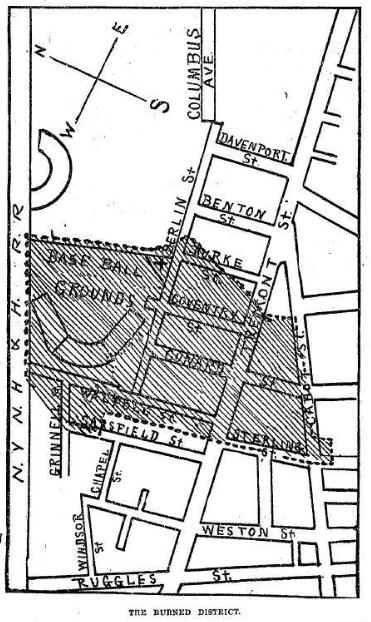
I particularly like this photo, because it shows what I imagine would have been the chapel of the Sacred Heart school. I assume this was the back of the building that extended behind the Puritan Theatre, as shown in the map directly above.


A future draper, working on a dress.


The caption for this tinted photo describes this girl as doing draper's work. A draper was the highest level of dressmaker, working to fit the individual as she assembled the dress, rather than working for measurements. This would have been high end work, so these girls were not all being prepared for low-income drudge work. 


A costume design student sketching at the blackboard.

Apparently, senior students could study costume design and do real creative work. I love that hat.


Evening class students making themselves dresses.

In the early years of the 20th century, Boston had many evening school programs. Some were for young people who had to work during the day, and others must have been for adults. We can see we're in one of the bow-front rooms that can be seen in the first photo above. And of course we can also see that this school was integrated. Most of the day students shown in the photos are white, so this may have been particular to the evening school. 


Learning to use stitching machines.

This scene is more like what I'd expect out of a trade school - learning to use machinery to do factory work. Or course the factories may have been quite small, and the girls could have worked doing alterations, or even started their own businesses. I've seen quite a few listings for dressmakers that were located in private homes.


Addendum: I just stumbled on this video from a 1911 short film showing the Manhattan Trade School for Girls, and it immediately reminded me of the photos above.


Wednesday, February 27, 2013

Two Scollay Scenes


I fell in love with this 1860 photograph of a horsecar passing by Pemberton square along Tremont Row.This is Scollay square wayyy back in the day. The day in this case is pre-Civil War days, when the horse car was a new conveyance on the streets of Boston. Just a few years before this photograph was taken, there were no rails in the streets, and passengers would have been riding in omnibuses, which were long, multi-passenger coaches pulled by a team of horses. With the use of rails, horses were able to pull significantly more weight, and cars got larger.


Scollay's building, very near the time of the top photograph, and just before it was taken down in 1870.. Both photos show the sign for the Middlesex Railroad, which operated the horsecar line shown above, which ran to Cambridge. 

When I first saw the top photograph, I wondered if I could identify S. R. Niles. Sure enough, Stephen R. Niles showed up in the 1855 Boston Directory at 1 Scollay's building. And the 1865 Directory identifies him as an advertising agent, with a home at 17 Pinkney street. The city took the building to open the street in 1870, and in 1870 Niles' business is located at 6 Tremont street.

George R. Hichborn, auctioneer,  first appears in the Boston Directory in 1855 at 10 Faneuil Hall. In 1865, Hichborn (and son, apparently) are in the Scollay building as seen above. In 1872, the building has been removed, and Hichborn & Co. is at 63 Court st. They were still present at that address in 1885, but by 1905, the company is not listed, and Samuel Hichborn is principal assessor in City Hall.

George H. Chapin doesn't appear in the 1865 Directory, showing up in 1870, just as the building is going to be taken and pulled down. This dates the second photograph above (if we can trust the directories) to a date between those two years. Google informs me that the farm agency was a real estate agency selling farms. When Scollay's building came down, Chapin moved to 24 Tremont Row, basically across the street. In 1885, Chapin is also listed as a publisher, and is located on Washington street, and in 1905, the listing is 'real estate and publisher' - no mention of farms any more - although in 1925, it's back to 'farm agency.'


Scollay square, with the Scollay building, marked in red, 1851 (BPL).The top photograph look from a building at Cornhill and Court streets, past the Scollay building, across Tremont Row and up Pemberton to Pemberton square.

If you're interested in Scollay square, make sure you visit this great blog.

Sunday, February 17, 2013

William Ladd Taylor's Washington Street

Busy Washington Street Scene, 1901, W.L. Taylor (BPL Flickr photo group). 


W.L. Taylor was a painter and  illustrator whose work was featured in The Ladies Home Journal. He was born in 1854 in Grafton, and studied art in Boston and New York. In the 1880s, Taylor had studios on School and Boylston streets in Boston, and was a member of various art clubs and societies.

Of interest to A.T.I.G.O.B. is the print featured above. I like to think that this print represents what we would have actually seen on a busy day at the turn of the 20th century. With the slow transportation of the day, pedestrians did cross the street as they pleased, and ragamuffin newsboys crossed paths - though not fates - with finely dressed ladies and their equally finely dressed children.

Beyond a look at the contemporary fashions, this print gives us a summary of downtown transportation. I wonder if the artist meant to put the electric streetcar directly between the horse carriage on the right, and the very new automobile on the left. And perhaps it's a coincidence, but the carriage, with it's driver at the top back, is reflected by the auto, which in this model also has its driver in the rear position, overlooking its passengers.

Sadly, we probably have a better sense of Victorian London than we do of the contemporary Boston. If only from Sherlock Holmes, we see the world of hansom cabs as being British, whereas our own cities would have appeared very familiar to Holmes and the rest of Victorian Britain's great literary characters. Unfortunately, while British writers explored their urban capital, Americans looked west for inspiration. And late 19th century America becomes the story of Cowboys and Indians, rather than Boston/New York/Philadelphia city dwellers. Henry James does write of Bostonians, but he chases them to Paris, and has no interest in the North End or South Boston.

Wouldn't you love to see a movie set in the Boston on 1901? If CGI can create alien planets for Hollywood, why not turn of the century Boston, with streetcars and carriages and automobiles all fighting to get through throngs of shoppers on Washington street?


Wednesday, February 13, 2013

Charlestown State Prison


Early print of Charlestown Prison -  looks like the illustration of a Poe story.


Charlestown, showing the prison and the new Prison Point bridge 1818.  (All maps, Norman B. Leventhal  Map Collection, Boston Public Library)


At the turn of the 19th century, Boston as it existed at the time was already criss-crossed with streets and built out. The Mill Pond had yet to be filled in, and the waters of the Back Bay came up to the edge of the Common. Yet Boston and the state had grown in population, and needed new and larger institutions  to keep up with their growth. Soon after annexing South Boston, a large plot of land was bought to locate Boston's new School of Reformation, House of Industry, House of Correction, and Lunatic Asylum. When the state had need for a new prison around the same time, nearby Charlestown was chosen for the site.


Charlestown State Prison, 1850 from the American Folk Art Museum.


Charlestown Prison, 1838. The land around the Craigie bridge has been filled from Lechmrere Point to the Prison Point bridge. The Lowell Railroad had built a branch line over to Charlestown, from upper right down across the Prison Point bridge.

The site chosen was along the waterfront at Lynde's Point. At the time, as shown in the maps above, a bay extended back between Charlestown and Cambridge.  The first prison was built in 1805-6, and began accepting convicts. I'll interject here that the Prison Point bridge seen on the maps was first planned as a tidal dam around the same time as the prison. After delays due to financial difficulties, the project shifted from being a dam from Lechmere Point to Charlestown, and became a bridge from the Craigie Bridge to Charlestown at the prison.


This 1859 map shows the proliferation of railroad line coming up from depots on Causeway street and past the edge of Charlestown to points north and west.


Additions were built in the 1820s and 1850s, as prisons went through a period of reform. The 'reform' may have been bad for the prisoners, as it involved  a turn to total isolation and silence during the day. No prisoner was allowed to speak to another prisoner, and the elimination of much petty corruption meant that prisoners could no longer bribe guards into allowing small favors. Prisoners were even prevented from sending or receiving letters to or from family. It did prevent violence among prisoners, and allowed them to serve their time in peace, if they could deal with the social isolation.


Charlestown Prison, 1885.


Charlestown prison guards, 1896. Apparently, obesity is not a recent thing.


Twentieth century view of the prison entrance.


Last but not least, the electric chair at Charlestown State Prison, 1909.

And yes, Charlestown State Prison became the home of the states' electric chair.  Luigi Storti was the first to be executed in the Massachusetts electric chair, in December of 1901. Sacco and Vanzetti. The last state executions were of Phillip Bellino and Edward Gertson in May of 1947.


Charlestown and prison, 1928 BPL Leslie Jones collection. (Click link for full size photo).


During the 1850s, the prison was seen as an overcrowed mess, and a new prison was built in Concord. After several years, for reasons that aren't clear to me, the prisoners were moved back to Charlestown. In 1956, a new state prison opened in Walpole, and the prisoners from Charlestown (then the nation's oldest prison) were moved there.  Bunker Hill Community College opened on the site of the Charlestown prison in 1973.


Sunday, February 10, 2013

Boston Boys and their Winter Games - 1850s

For your winter enjoyment


A favorite book of mine is Old Boston Boys and the Games They Played, by James D'Wolf Lovvett. Published in 1906, it looked back on childhood (or rather boyhood) during the pre-Civil War years of the 1850s. The boys featured were Beacon Hill boys, although the adventures of West and South End boys enter the story. It's the story of Yankee boys, when there seemed little need yet to discriminate among Boston's ethnic mix. There are 'colored' people present, residents of the back of Beacon Hill, and perhaps the West End, and 'Hibernians' and Italian vendors gain a mention, but to the author, Boston boys are the sons of Yankee Beacon Hill.


 "Just over a low ridge of ground, which is now Arlington street, was the "Back Bay," a sheet of water that extended from the Mill Dam to Boston Neck, and many a time we boys struck straight across upon the ice from the corner of Arlington and Beacon streets, to where Chickering's piano factory now stands." 


I pulled out this single sentence about ice skating on the ice of the Back Bay to feature. The 1852 map above shows the degree to which the South End had already been filled. It also shows the Back Bay before it was filled, with two railroad line criss-crossing it on timber trestles. Note that the Back Bay was not entirely open water - there were apparently low islands of grass. Assuming this map to be correct, I suspect the boys setting off from the corner of Arlington and Beacon streets would have been forced to skate around the large island between there and the later site of Chickering's piano factory. In fact, Chickering's is shown here near the end of a sliver of water, and probably beyond where the boys skated.

Note also that there is no mention in the quote above of skating under the railroad trestles, which would have been required of anyone skating between those two sites. The blue line shows the most likely route followed by the skaters, from the edge of the Public Garden, under the Boston & Providence trestle, and then turning right and running between that trestle and the shore of the South End, under the Boston & Albany trestle, and on as far as open ice allowed. The author comments that to go the other way, towards Gravelly Point and the dam, one would approach fast running water as the tide shifted, which kept the ice thin or entirely open, and thus was a great danger.

And now, from skating to coasting:

Of course, the winter sport par excellence was coasting, and those Boston boys whose boyhood was at the zenith in the fifties include coasting, as it was then practiced, among the lost arts. If any of the youngsters of to-day are inclined to laugh at this statement, let any one of them, athlete though he may be, take a running start of from three to ten yards at full speed with the sled following at the end of its cord, and when sufficient impetus has been acquired, throw it ahead, letting the line fall along the seat, at the same time launching his body, curved bow-wise, forward through the air, alighting breast first, with no apparent effort, jar, or retardment of speed as softly as a falling snowflake, upon the flying sled as it shoots underneath. This would be called pretty, acrobatic feat to-day, but was too common then to attract special notice. That's the difference.

All coasting in those days was racing, pure and simple. Prominent sleds were as well known among the boys as race horses and yachts are today, and on any given Saturday afternoon hundreds of spectators might be seen hedging in the "Long Coast," which ran from the corner of Park and Beason streets to teh West Street entrance and as much farther along Tremont Mall as one's impetus would carry him. A squad of coasters would be bunched together at the top of the coast, holding their sleds like dogs in leash, waiting for some "crack" to lead off. As he straightened himself and started on his run with the cry of "Lullah!" to clear the way, it was the signal for all to follow, and one after another would string out from the bunch after him, in rapid succession, each keen to pass as many of those ahead as possible,the lesser lights being careful not to start until the "heavyweights" had sped on their way.

The walk back uphill was made interesting by discussing the merits, faults, lines, etc., of the noted sleds, and if, as often happened, invidious comparisons were made between a "South End" and a "West End" sled, a lively and not altogether unwelcome scrap, then and there, was usually the logical outcome.

Sleds (the first-class ones) were made with much care and skill, and cost proportionately. Natural black walnut was a favorite material, finished either with a fine dead polish or a bright surface, varnished with as much care as a coach; the name, it it bore one, was usually a fine specimen of lettering in gold or bright colors. The model was carefully planned, and the lines were graceful and a delight to teh eye of a connoisseur. Black enameled leather, bordered by gold or silver headed tacks, made a popular seat, and the "irons," as they were called, were made of the best "silver steel," whatever that meant. They were kept burnished like glass, with constant care and fine emery and oil, and a streak of ashes or a bare spot was avoided as a yacht steers clear of rocks.

The amount of "spring" given to the irons was also a matter of moment, and a nice gradation of the same was thought to have influence on the speed; it certainly added greatly to one's bodily comfort.

"Let's see your irons" was a common request, and the owner thus honored would jerk his sled up on its hind legs, so to speak, wipe ff the steel with mitten or handkerchief, and show off the bright surface with much pride.

The most popular coasts were the "Long Coast' already mentioned, the Joy Street coast, Beacon Street Mall, and the "Big" or "Flagstaff" Hill, the flagstaff standing on the spot now graced by the Soldiers' Monument. The hill was much higher than it is now, the ground around it having been raised in recent years. Many of the boys will recall the evenings spent on Mount Vernon and Chestnut streets and Branch avenue, - the latter known as "Kitchen" street.

Fancy a laughing, shouting crowd, in these days of police surveillance, coasting down public streets until eleven o'clock at night! But the Civil War came and changed many things, coasting among the rest. Most of the laughing, careless crowd enlisted at the first note of the country's call, and their boyhood came to a sudden end as the sound of drum and fife stirred all hearts to sterner things. Some came back, but many, alas, stayed behind with the great silent army, and it is for us who are left to keep their memories green until we too are enlisted in the same ranks.

It will, I am sure, be of some interest to may who remember those days, to see once more the old familiar names of a few of the crack sleds of Boston at that period, and to have recalled to their minds who the owners of them were.

Wivern - Bob Clark
Raven  - Arthur Clark
Brenda - Dan Sargent
Charlotte - Alfred Greenough
Comet - Frank Wells
Southern Cross - Frank Lawrence
Eagle - Jim Lovett
Arrow - John Muliken
Wild Pigeon - Ned Kendall
Tom Heyer - Jack Carroll
Titania - Nate Appleton
Multum in Parvo - Frank Peabody
Cave Adsum - Ned Amory
Dancing Feather - Charlie Greenough
Flying Childers - Frank Wildes
Juniata - Horace Bumstead
Trustee - Charlie Chamberlin
Santiago - Dick Robbins
Whiz - Will Freeman
Flirt - Horace Freeman
Scud - Eben Dale
Flying Cloud - Billy Fay
Cygnet - Jim Chadwick
Alma - Fred Crowninshield
Tuscaloosa - Horatio Curtis
Viking - Edgar Curtis
Moby Dick - Henry Alline


Of course there were many sleds equally fine which bore no name; prominent among this latter class should be mentioned the one owned by Tom Edmands and also one which was made and owned by Charlie Lovvett, both of them beautiful in grace, workmanship, and finish. There was one sled, named the "Edith," which always appealed to me as being more nearly perfect than any that I can remember. I cannot recall the owner's name, but I fear that whenever I saw this sled the tenth commandment was handled pretty roughly. 


I can well imagine the boys and the pride they took in their sleds. The names sound like sailing ships - so romantic. I found a single reference to Tom Heyer as America's first boxing champion, although it will take some off-line digging to verify and elaborate on the fact. The reference to the 'great silent army' put a lump in my throat, and made the entire passage worth reading on its own.


Monday, January 21, 2013

Alger's Gun Works

Cyrus Alger, 1827.


Cyrus Alger was born in West Bridgewater Massachusetts in 1781, and learned metal casting from his father. He set up a foundry in  Easton, and in 1809 moved to South Boston, recently stolen (legally, of course) from Dorchester and annexed to Boston . One source has him supplying cannon balls to the government during the War of 1812.


Cyrus Alger mortar, cast in 1863, currently located on the grounds of the North Carolina State Capitol (Wikimedia Commons).


Alger's Iron Foundry, South Boston, 1852.


In 1816, Alger bought from the South Boston Land Association most of the land west of the Dorchester Turnpike (now Dorchester avenue), and soon began filling in the mudflats of the South Bay. Here, he built his foundry, and made a name for himself as one of the leading metallurgists of his time. Alger developed a process for purifying cast iron, producing a much stronger material, and produced the first rifled gun in the nation. He personally supervised the pouring of the Columbiad, the largest gun to be produced up until that time.


From the Boston Directory, 1848-49. Although now known for his cannons, Alger's company supplied castings for many commercial uses. He had patents for improving both stoves and plows.


The red 'X' marks the 1855 location of the Alger foundry in South Boston, and shows both water and railroad access (BPL map collection). Much of the land at the site marked above was created by Alger.


Closeup map view of Cyrus Algers' Boston Iron Works, Iron (later Foundry) street, South Boston, 1852. The South Boston (Dover street) bridge crosses the South Bay on the left, and the Turnpike to the right.The site had both water and rail access - note Alger's Wharf  and the tracks of the Old Colony railroad.


Alger's gun yard, end of Sixth street, at the outer edge of South Boston (red), United States gun yard (blue) 1852. Cannon were tested by the batch. Samples would be taken from each batch, and fired into earthen walls repeatedly to test for defects. If there were no failures, the batch would be shipped.They also fired guns from Nut island, Quincy towards a target on Peddock's island.


Cyrus Alger was also active in the community. He served on Boston's Common Council and as an Aldermn.  He paid to have sidewalks laid and trees planted along Dorchester avenue. He is said to have kept his workers on half time when they weren't needed, and introduced the 10 hour day to South Boston industry. When he died, stores closed along the route of his funeral, and factories all over South Boston shut down. Today, Alger cannons sit in front of Town Halls and on village greens all over the country, and are bought and sold by collectors as pieces of American history.


Sources: Gaining Ground: A History of Landmaking in Boston, Nancy S. Seasholes.

 A genealogical history of that branch of the Alger family which springs from Thomas Alger of Taunton and Bridgewater, in Massachusetts. 1665-1875